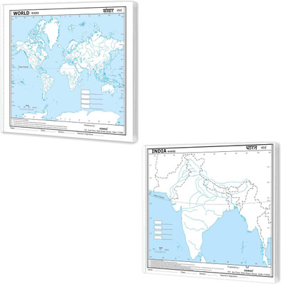
SMALL - 100 INDIA RIVER OUTLINE MAP FOR SCHOOL And SMALL - 100 WORLD RIVER OUTLINE MAP FOR SCHOOL|Combo Of 2 Maps | A Journey Through Waterways(Paperback, GOWOO)
Quick Overview
Product Price Comparison
"The combo of the ""Small - 100 India River Outline Map for School"" and the ""Small - 100 World River Outline Map for School"" is an excellent educational package that offers students a comprehensive understanding of river systems both at the national and global levels. These maps provide valuable resources for studying and exploring the rivers of India and significant rivers from around the world, understanding the rivers in shaping our planet's landscapes and sustaining life. The small India river outline map size is 7*8 inch, and the world river outline map size is 7*8 inch, and both can tear out.The ""Small - 100 India River Outline Map for School"" focuses on the rivers within India. It presents a detailed outline of the major rivers Students can identify and label rivers such as the Ganges, Brahmaputra, Yamuna, Godavari, Krishna, Narmada, and many more with this map. They can learn about the course, and drainage patterns of these rivers, gaining insights into India. This map also allows students to explore the states and landmarks associated with these rivers.On the other hand, the ""Small - 100 World River Outline Map for School"" provides a broader perspective by showcasing major rivers from different continents worldwide. By studying this map, students can compare and contrast these rivers' characteristics, lengths, and locations, understanding the global distribution and importance of rivers in different regions. This map also encourages students to explore these rivers and the environmental.The combo of these two maps offers a unique opportunity for students to explore the interconnection between local and global river systems. By studying the rivers of India and their significance within the context of the world's major rivers, students can develop a comprehensive understanding of the role rivers play in shaping landscapes and supporting ecosystems. They can examine similarities and differences between river systems.These maps are not only informative but also interactive and engaging for students. They provide clear outlines of the rivers, allowing students to label and colour them using different markers or pencils. "


